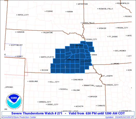
As the cold front and low move east this morning, the wind fields will definitely be supportive of possible tornadoes, if more thunderstorms can form along the front. While I do not think there is enough instability this morning...and with all the clouds around I do not foresee us destabilizing...with the potential for a short lived tornado or two if storms were to form, I have to at least mention the possibility. What will likely happen is the cold front will move east of us and some more showers, maybe even a rumble of thunder, will effect us from time to time today. Keep a look out though, and listen for any potential warnings. The best chance for severe weather will be between now and the early afternoon. Beyond that, the front will move through and temperatures will drop, likely ending up in the 50s by sunset.
No comments:
Post a Comment