Thursday, October 28, 2010

Waterspouts in Oswego!

One of the major draws to SUNY Oswego for meteorology majors (besides the epic snow) is the waterspouts that occur every fall over Lake Ontario. For those that are not familiar with waterspouts, they are similar to weak tornadoes over water. They are caused in part by the stark differences between the warm lake waters and cold air over top, hence why they occur mostly in the fall.

As the 4th and final fall of my time at Oswego began to draw to a close...I had begun to relent to the fact that waterspout season was ending and, in all four of my years, I had not yet seen one. I have had many close calls, but they are typically short lived and difficult to spot. However, today, my patience finally paid off and I was treated to a total of three waterspouts!

And, the number one rule of a meteorologist is to ALWAYS have your camera on hand. And so, thanks to that rule, here are some pictures of the waterspouts I witnessed at long last! Enjoy!


It may not look like the previous pictures'
waterspouts were touching the water. However,
this picture, in the middle, shows the "spray
ring" beneath the funnels. Even though invisible,
the circulation of these waterspouts most
certainly extended from cloud to water.
Even with the 24x zoom on my camera, it is
still difficult to see the spray. Look right above
the water, just slight right of center.


This was the last funnel I saw, and the hardest
to see/photograph. The lighter gray area in the
top center is the funnel. This one only lasted a
couple minutes and was much closer to shore
than the other two.

Thursday, September 30, 2010

Major Flooding Reported

9:45PM UPDATE: The rain in Pennsylvania has still not turned east and is making me very nervous. The rain is as far north as I-80 in Central Pennsylvania. I unfortunately will not be able to update again until after after 12:30am. I will post a quick update at the time though.

The back edge of the rain shield is beginning to move through the Grotonweather tri-county area and will continue to do so over the next hour or so. Rainfall totals are over 3" over most of the area, and radar estimates max out at 4-5" over southern Cortland County. In all honesty though, it appears the radar is under estimating the precipitation, so I would not be surprised if places like Marathon got even more.

As I have been saying, if these rainfall amounts occurred in our area, the ground would not be able to handle it. Unfortunately, that prediction has come true. Here are a couple of the flooding reports I have heard so far, all from Cortland County:
  • NO UNNECESSARY TRAVEL IN CORTLAND COUNTY UNTIL FURTHER NOTICE
  • Route 11 between Reagen Road and Hoxie Gorge Road is CLOSED due to a mudslide
  • Other mudslides have also been reported
  • In Homer: The Haights Gulf Bridge is out.
  • In McGraw: Roads IMPASSABLE throughout the village
  • Red Cross Shelter for evacuees in the gymnasium at the County Office Building
I have not heard of any flood reports in Tompkins or Cayuga Counties, but that does not mean it is not occurring. I cannot stress enough, never drive through flooded roadways!! There are roads underwater in the area. DO NOT attempt to cross the flood waters. Doing so may put your life in jeopardy. If you are told to evacuate your home, do so!

As I stated at the start, the rain is ending. However, this does not mean the flood threat is ending! Runoff will continue to create flood problems into tomorrow. Area rivers are not expected to reach their peak heights until about this time Friday.

There may be some additional rain tonight. What is left of Tropical Storm Nicole is moving up through North Carolina and Virginia currently. The models have consistently kept this rain off to our east tonight. However, the fact that the models were too far east with today's storm, and the fact that the radar from that region looks very much like it did last night (namely a large area of rain seemingly heading right at us) has me a little nervous. I should stress, though, that we are not in the same sort of set up now, and, thankfully, I do see indications in the upper atmosphere that this rain will turn to our east, as the models indicate. If the models were wrong, which I do not think they are, and we were to get another couple inches of rain tonight, it would be disastrous. Again, I do not think this will be the case.

In summary...the rain may be ending, but the flooding will continue into tomorrow. Stay safe!!!!

Heavy Rain Update: 4PM

4:40PM UPDATE: FLOOD WARNING ISSUED FOR S.CORTLAND AND TOMPKINS COUNTIES THROUGH 7:15 PM.

Very heavy rain has been falling across the area and will continue to do so for the remainder of the afternoon and into tonight. The regional radar loop is showing the rain tapering a bit to just showers, but not until far Southern Pennsylvania. Even then, there is still some heavy rain...just not as widespread. We very well may only be about half way through this event, and already rainfall totals are getting quite high. Take a look at some of these reports:

Game Farm Road Climate Station, Ithaca: 1.36" through 3PM
Freeville: 1.41" through 3:42 PM
Virgil: 1.54" through 3:42PM
Binghamton Airport: 1.36" through 3PM
Deposit, NY (Deleware County): 2.99" between 7AM-1:22PM

If we double these amounts, most places will be up around 3-4", as expected. There are no flood warnings in the Grotonweather.com forecast area, but most of the counties to our south, east and north are under flood warnings. Most of these flood warnings are for larger rivers in anticipation of this additional rain. No flash flood warnings are in effect yet.

There are actually some more intense areas of rain and wind within the main area of heavy rain. A severe thunderstorm warning was even issued for Broome County a little while ago! I changed the scaling on the radar program I use to make these areas stick out. The brighter the color, the heavier the rain. The heaviest rain seems to be concentrated over the Finger Lakes, with some of those heavier cells moving through Cayuga and Cortland Counties, as indicated by the dark reds and pinks. It is where these cells hit that the greatest chance for rainfall totals over 4" will occur.

As we go into the evening hours, I am anticipating starting to see some flash flooding problems as we start to approach the upper limits of what the ground and streams can handle. I will get the word out about any Flash Flood Warnings as soon as possible. Remember, NEVER drive through a flooded roadway! If you come to a roadway, turn around. There is no telling just how deep the water is. Just 6" of quick moving water can sweep a car away! It is especially dangerous at night, when it is even harder to see flood waters. Anytime you get rainfall of this magnitude in such a short (about 12-18 hours) time span, the runoff can produce dangerous conditions. Please stay safe tonight, and stay tuned to Grotonweather.com for the latest! Do not forget to visit the chat room by clicking the "Open Chat" icon to the right. The Chat will be open through the early evening. Furthermore, make sure you tune in for tomorrow's podcast as we talk about this event!

Note: One of the quickest ways to get updates from Grotonweather.com is on our facebook page! Become a fan now by clicking here!

Wednesday, July 21, 2010

Are we done YET?

6:45 PM Update: A severe thunderstorm warning is in effect for the very southern most portions of Tompkins and Cortland counties, but the storm is pretty much south of the county lines. Looking upstream, the more impressive thunderstorms should pass well to our west and east as the cold front begins to press through. As a result, I think we are pretty much done with severe weather here in the Grotonweather forecast area. There will likely be a shower or two...maybe even a light thunderstorm...over the next few hours...but the biggest hazard from here on out through tomorrow morning should be some areas of dense fog.

5PM Update: The storms over Ontario County have struggled to organize and are falling apart into just showers.

UPDATE 4:30PM:
As I suspected (but a bit quicker I must admit), a healthy looking cell has broken off the lake breeze and is holding itself together nicely over Ontario County with some new development along its southern flank. If it keeps holding together, it should reach Cayuga Lake about 5:15-5:30 before heading into the Grotonweather forecast area between 5:30 and 7pm.

Original 4PM post: The Grotonweather forecast area has been hit hard twice today, with only the northern portions of Cortland County missing out on the active weather (but not by much, as southern Onondaga County has been hammered too!) Numerous severe weather reports have come out of the area, the most notable being trees and powerlines down in Lansing early this afternoon and a recorded wind gust of 55mph in Locke, 1.25" hail in Dryden and 1" hail in Cortland with the second round of storms.

So...are we done yet? For a little while at least. What has been happening is lake breeze fronts from Lake Erie and Ontario have been triggering storms between Rochester and Buffalo. These storms have been sitting and redeveloping over the same area for hours. As the individual cells move away from the lake breeze, they have been tracking southeast across the Finger Lakes, right into our neck of the woods. the last big storm that went through our area stabilized the atmosphere a good deal, and so as the cells break off of the lake breeze, they have started to quickly die out. I tend to doubt this will remain the case though. The sun is out and already working to destabilize the area once again. Eventually, I believe that another storm will have enough fuel to head down towards us once again, probably in the 1-3 hour time frame. After that, the lake breeze will start to die out. However, the cold front still has to come through and encounter a still unstable airmass across Western New York. more storms may fire up along that as it moves east...especially if it does so while the lake breeze is still adding extra lift to the atmosphere.

Bottom line: we may not be done yet...so stay tuned!

1PM Severe Weather Update

2PM Update: SEVERE THUNDERSTORM WARNING FOR S. CAYUGA COUNTY UNTIL 2:45 pm. A severe storm over Ontario county will move into S. Cayuga county over the next 30-60 minutes. I expect the warning to be extended/overlapped as the storm moves into the area. If the storm remains severe (and there is not really any reason for it not to), Groton, Homer and Cortland will have to watch out for this storm between 3-4 pm. Interesting note: All of the Grotonweather forecast area but extreme northeast Tompkins and northern Cortland Counties have been under severe thunderstorm warnings at some point today already! And our watch goes for 6 more hours.

Original 1PM post: Lots going on this afternoon already. A severe storm tore through central Tompkins county last hour. It is looking a bit less organized as it moves into S. Cortland county. I was in Ithaca, on the 11th floor of Bradfield Hall, Cornell as the storm passed. There was rotation with it, and I got some awesome pictures I will post tonight. The storm produced 1" hail in Trumansburg and took out "many" trees and powerlines in Lansing. No other reports yet (as of 1PM).

While all this was going on, the SPC moved us into a moderate risk. This is primarily for the threat of damaging winds. Now, we've already experienced severe weather...but is more on the way? Our watch goes until 8pm, afterall. The answer is yes, our threat still continues. There are more showers and storms forming over western New York back into Canada. The cold front itself stretches from Ontario back into Ohio and Indiana. The air just upstream is very unstable, and the storms we've already had shouldn't have much of an effect on our instability for the middle or latter part of the afternoon.

If you haven't become a fan of Grotonweather on facebook or a follower on Twitter, you will want to do so now! I've been posting up a storm (pun intended) on those two sites all morning with the latest updates and will continue to do so through the day. Also, the Grotonweather Toolbar is a great way to keep your eye on the latest forecast. Download it here. And, as always, the main site/blog will be updated throughout the day to keep you safe!

That's all for now. Keep checking back!

Wednesday, July 14, 2010

The GrotonWeather Toolbar!

http://grotonweather.OurToolbar.com/

That is the hottest link around right now. Click it, and you can download the GROTONWEATHER TOOLBAR...the latest way to get your forecast quick and easy! Downloading this toolbar will allow you to have some great features displayed at the top of your browser window. Here is an explanation of each of the features in order, from right to left...

ToolbarLogo: Clicking on this will take you to the Grotonweather homepage. Additionally, there is a little white arrow just to the right of the logo. Clicking on this will drop down a menu with additional links. Of these, the most important is probably the "refresh toolbar" link at the top, especially if you leave your browser open for long periods of time. The forecast automatically updates around 6PM, so if you do not see a forecast for tonight by 6PM, click the refresh toolbar link!

Search Box: The search box is a staple on most toolbars, and allows you to easily search from the toolbar. The site I am using to create this toolbar does not allow for many options regarding the customization of this. As such, every time you highlight text, it automatically gets put into the search box. Click the arrow, and then you search for it! The sliding bar on the far right part of the image allows you to shrink and expand the search box. I suggest shrinking it down as far as possible, to allow room for the other content!

Forecast: Your forecast is shown here. The forecast automatically changes to the night forecast at 6PM. If it is after 6PM and you do not see the night forecast, hit the refresh toolbar link, as explained in the "toolbar logo" section. At the far right side of this, in brackets and color, is the "hazard of the day". Each day, the primary mode of hazardous weather you need to worry about will be displayed here. The colors correspond to the risk. For example, a red risk will be much more serious than a green or yellow one. If you move your mouse over the hazard, the forecast will disappear to show...

Hazard Text: This is just a simple message that takes the place of the forecast to inform you that there may be other hazards besides the one listed. Following that message is a link to the Grotonweather homepage to see what other hazards may be in store. Moving your mouse over the blue "return to forecast" text will display the forecast once again.

Twitter Feed: Even if you are not a fan of twitter, you can still get updates from Grotonweather's twitter channel here! Click the bird to display the latest posts in a drop-down window below the bird.

[pic not available yet] Doppler Radar: Clicking this box (its red with a sun icon in it) will bring up a map of the United States. Click New York (or any state) and the radar loop for that state will pop up.

Live Time & Temperature: The time and temperature are displayed live here. Clicking on the image will take you to the live stats from Groton. If the time appears out of date, then you may need to refresh your toolbar!

Scrolling Alerts: A Grotonweather original feature, any watches, warnings or advisories will be displayed here. As with the scrolling text on the main site, this is difficult to keep updated manually and may occasionally be out of date or miss displaying all alerts. This is something that will hopefully be automatically updating in the near future!

I hope you enjoy this toolbar. Make sure to suggest it, and grotonweather.com, to your friends and family! Don't forget to join us on Facebook and Twitter too!!

Wednesday, June 23, 2010

Video: Severe threat update

Into the Moderate Risk

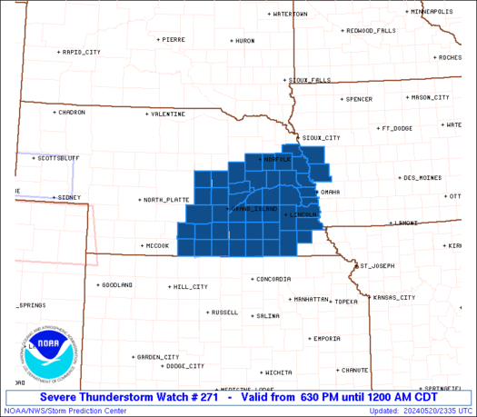
The Storm Prediction Center has moved our area into a "moderate risk" zone. This is their 3rd of 4 severe weather categories...and the 4th and final one is rarely issued anywhere, and I cannot say that I have seen it used up here. I would say we see a moderate risk every other year or so. Sometimes we get in a pattern where we get a couple in a short time span, but then there are occasions when we don't get any in a whole year. So, in conclusion of all that...when the SPC puts out the moderate for our area, its time for me to really look at things.

So what is going on that has prompted this? A strong area of low pressure with strong winds aloft will be moving eastward towards us overnight tonight. This system has produced plenty of severe weather already. Currently, there is a line of thunderstorms stretching from Michigan down into Indiana, then stretching back into Illinois and Iowa as the low moves across Wisconsin. These storms will not effect us. The part of the line moving across Michigan will turn southeast and die out. However, in its wake, new storms will develop later this afternoon and form into another cluster. This cluster will move eastward into Western New York later this evening and into the first part of the night and then towards our area after midnight. As it crosses Michigan, southern Ontario and into western New York, it will be producing widespread damaging winds...and it is for that reason that the moderate risk has been posted.

The question for us, on the far eastern edge of the moderate risk, is whether or not the line's severe potential continues overnight. We are in the 45% range for damaging winds. That percentage means the SPC thinks there is a 45% chance of damaging winds within 25 miles of a point. Statistically, from the center of the Grotonweather forecast area, a 25-mile radius covers the entire forecast area and some...so we can assume just a slightly lower probability of damaging winds in our area...very roughly 40%. That may not seem like a very high chance, but in reality, it is. I, however, am not so convinced, and would put the threat at maybe 20-30%. Here is why:

By the time the storms come over here, it will be well after dark. Typically, this would be very unfavorable for any severe weather with the loss of the daytime heating. However, our instability will actually increase overnight and, if the models are correct, peak sometime near or after sunrise tomorrow morning. From what I have been seeing on the models, the line should run our ahead of the main instability and thus weaken itself. Additionally...it will also likely outrun the upper level forcing and stronger winds aloft, which also come through tomorrow morning. If the timing of these matched up better, I would be more convinced a once-every couple years event was indeed unfolding.

Does this mean severe weather is not possible tonight? Absolutely not. These complexes of thunderstorms often develop their own mechanisms for keeping themselves going. If this were not the case, I wouldn't be overly concerned at all. Our instability will still only be marginal to moderate and, as I said earlier, the forcing and upper level winds aren't quite as good as a real classic event would have them. But since these things have a life of their own, there very well could be damage across our area overnight tonight. I do not feel at this time that the damage will be widespread, and certainly not on the scale of our area's most infamous overnight line of storms: The Labor Day 1998 event that destroyed the New York State fairgrounds.

Bottom line is this: Sometime after midnight, a line of thunderstorms should roll through our area. Frequent lightning, heavy rain, maybe a little small hail and gusty winds are likely. Some wind damage is not out of the question, but shouldn't be widespread. Rain and thunderstorms may continue to impact the region tomorrow morning though. Some models have shown very heavy rain in here tomorrow morning, so flash flooding could become a threat.

If anything looks like it has changed, I will post another update this afternoon. Otherwise, an update will be issued around 9m tonight to see how things have evolved through the day.

Sunday, June 06, 2010

Tornado Watch to the south

An early morning tornado watch is in effect for the counties just south of Tompkins and Cortland counties down through Pennsylvania and Ohio. There are severe thunderstorm warnings for those same counties (Chemung and Tioga specifically) as thunderstorms out ahead of a cold front move across the area. The cold front is back over Western New York/Pennsylvania, with the low itself sitting over Western New York. With severe storms and a tornado watch on our doorstep, I felt a blog update would be more prudent for today.


As the cold front and low move east this morning, the wind fields will definitely be supportive of possible tornadoes, if more thunderstorms can form along the front. While I do not think there is enough instability this morning...and with all the clouds around I do not foresee us destabilizing...with the potential for a short lived tornado or two if storms were to form, I have to at least mention the possibility. What will likely happen is the cold front will move east of us and some more showers, maybe even a rumble of thunder, will effect us from time to time today. Keep a look out though, and listen for any potential warnings. The best chance for severe weather will be between now and the early afternoon. Beyond that, the front will move through and temperatures will drop, likely ending up in the 50s by sunset.

Wednesday, February 24, 2010

Snow Map

There have only been a couple changes to the forecast in the past 24 hours since last night's blog entry. Firstly, there is little question now that the entire storm over our area will remain as snow. The main stream of warmer air will remain north of us, and I question how far west it will make it. This makes it a very difficult forecast for Syracuse, but I think even they will remain mostly or all snow. The second change is more precipitation for the Grotonweather area. These two factors combined have given me the confidence to up my snow totals to 12-18" for most of the area. Here is my snow map for the entire storm.


I apologize for not having more updates today and not having a video, but its been a busy week at school this week. I am planning to do a video tomorrow morning though, so make sure to check in sometime after 10am. Oh, and Groton students, enjoy your day off- School has already closed for tomorrow!

Tuesday, February 23, 2010

Largest Snowfall of 2009-2010 Winter Looming

The largest snowfall for the Grotonweather.com area is on our horizon. This storm has consistently been on the models since Saturday, and I've just been waiting for it to become obvious that it won't happen. Over the past day and a half, I began to believe that this storm actually was going to happen, but the models remained inconsistent with the timing and exact location. There are still plenty of uncertainties to be figured out, but its time to start nailing down the seriousness of the storm. My main concern is not how much snow actually falls, but rather the blowing of the snow as the low explodes to our southeast. It will be a significant snowfall too, probably on the order of about a foot, but winds will make it seem like its snowing even heavier with near zero visibilities at times. Lets take this storm one aspect at a time.

Overall Pattern:
Low pressure is developing off the Southern New England coast this evening and tracking north. This is not the main storm. As it moves north, it will run into a sprawling area of high pressure and begin to weaken. Meanwhile, an upper level trough will dig into the eastern third of the county. This will create prime conditions for explosive storm development off the coast yet again. This low will absorb some of the energy from the dying low and continue to rapidly intensify. As it moves north towards New England, it will encounter that same high pressure, and begin to move more westerly. Over time, the storm, which still wants to move to the northeast, will do a loop over Southern New England and Southeastern New York, before heading out to sea.

Timing:
The snow will being to work into our area sometime in the morning Thursday and become heavy into the afternoon and evening. The snow will taper off in intensity Friday, but will still be around. By Saturday, everything should be pulling out, making the total time of this storm somewhere around 36 hours, with probably 12 hours of the heaviest snow.

Precipitation:
Snowfall totals are still a bit up in the air. I am concerned that warm air wraps around the system and causes a variety of precipitation types. The further to the west this storm comes, the more a concern that is. If we did change over to rain for a while, it would be later Thursday evening most likely. The models are not in agreement with whether or not this will happen, and it will have huge impacts on the total snow fall from this storm. Assuming an all snow event, which I think it probable at this time, snow fall totals should end up around a foot, give or take a couple inches. Expect a snow map Wednesday evening.

Winds:
With the low pressure coming into Southern New England and even Eastern New York, winds will become quite strong. Winds could be sustained near 25 mph for a time Thursday afternoon and evening with higher gusts. With the heavy nature of the snow, this could cause some tree damage and power outages, not to mention near zero visibilities and large snow drifts.

Temperatures:
Temperatures during the storm should stay in the upper 20s and low 30s for Thursday (mid 30s if we change to rain, but I just am not seeing that) before dropping off a bit Friday.

Stay tuned for the latest, as I will be tweaking this forecast over the next 24-36 hours. I will try to get a forecast video done tomorrow evening.

Tuesday, February 09, 2010

3PM Snow Video

NOTE: The watches, warnings and advisory part of the show is already out of date, with a WINTER WEATHER ADVISORY in effect for the entire Grotonweather.com forecast area, and WINTER STORM WARNINGS in the bordering counties south and east. Enjoy the video...leave comments!


Sunday, January 24, 2010